| Location |
| City: | | Earlton, Ontario, Canada |
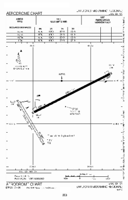
| Name: | Earlton (Timiskaming Regional) Airport |
| ICAO / IATA: | CYXR / YXR |
Details |
| Type: | Airport (Airfield) |
| Use: | Public/Civil |
| Latitude: | 47°41'42"N (47.695000) |
| Longitude: | 79°50'56"W (-79.848888) |
| Elevation: | 800 ft (244 m) |
| Runways: | 2 |
| Longest: | 5998 ft (1828 m) |
Time |
| Timezone: | UTC+29:08 (DST+32:08) |
| Local Time: | |
Weather |
| METAR: | CYXR | 041400Z AUTO 36009KT 9SM -SN OVC021 M13/M15 A3003 RMK ICG SLP193
|
| TAF: | CYXR | 041240Z 0413/0501 36006KT 5SM -SN OVC015 TEMPO 0413/0416 P6SM NSW SCT015 OVC025 PROB30 0413/0416 4SM -FZDZ BR BKN008 OVC015
FM041600 07010KT P6SM SCT008 OVC020 TEMPO 0416/0418 2SM -SN BKN008 OVC020
FM041800 07010KT 6SM -PL BR OVC020 TEMPO 0418/0420 2SM -SN
FM042000 07010KT 6SM -PL BR OVC020 RMK FCST BASED ON AUTO OBS. NXT FCST BY 041800Z
|
Related Locations |
| Nearby: | |
| Farthest: | YAUG: 11228 mi / 18070 km
Augusta [Augusta Airport], WA, AU |
Find: |
|
Other Information |
Maps:
|
Sources:
|
|