| Location |
| City: | | Abbotsford, British Columbia, Canada |
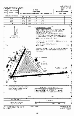
| Name: | Abbotsford International Airport |
| ICAO / IATA: | CYXX / YXX |
Details |
| Type: | Airport (Airfield) |
| Use: | Public/Civil |
| Latitude: | 49°01'31"N (49.025278) |
| Longitude: | 122°21'36"W (-122.359999) |
| Elevation: | 194 ft (59 m) |
| Runways: | 2 |
| Longest: | 9597 ft (2925 m) |
Time |
| Timezone: | UTC+26:08 (DST+29:08) |
| Local Time: | |
Weather |
| METAR: | CYXX | 041400Z 05024G35KT 10SM SCT065 OVC120 M08/M19 A2967 RMK SC4AC4 SLP052
|
| TAF: | CYXX | 041138Z 0412/0512 06025G35KT P6SM SCT030 OVC050 TEMPO 0412/0416 2SM -SHSN BLSN BKN030 OVC050
FM041600 05025G35KT P6SM BKN080 BKN120 TEMPO 0416/0418 3SM BLSN
FM041800 05025G35KT P6SM FEW080 SCT150
FM050000 05010G20KT P6SM SKC BECMG 0502/0504 05012KT RMK NXT FCST BY 041800Z
|
Related Locations |
| Nearby: | |
| Farthest: | FAME: 11512 mi / 18526 km
Marion Island, Prince Edward Islands, WC, ZA |
Find: |
|
Other Information |
Maps:
|
Sources:
|
|