| Location |
| City: | | North Bay, Ontario, Canada |
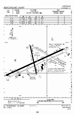
| Name: | Jack Garland Airport |
| ICAO / IATA: | CYYB / YYB |
Details |
| Type: | Airport (Airfield) |
| Use: | Public/Civil |
| Latitude: | 46°21'50"N (46.363889) |
| Longitude: | 79°25'27"W (-79.424166) |
| Elevation: | 1215 ft (370 m) |
| Runways: | 3 |
| Longest: | 10004 ft (3049 m) |
Time |
| Timezone: | UTC+29:08 (DST+32:08) |
| Local Time: | |
Weather |
| METAR: | CYYB | 041400Z 03009G18KT 340V060 15SM OVC010 M08/M09 A2990 RMK SC8 SLP149
|
| TAF: | CYYB | 041338Z 0414/0502 05012KT P6SM OVC010 TEMPO 0414/0418 3SM -SN -FZDZ BR BKN008 OVC015 PROB30 0414/0418 6SM -PL BR BKN005 OVC008
FM041800 07012G22KT 2SM -FZRA BR BKN005 OVC008 TEMPO 0418/0422 6SM -FZRA BR OVC010
FM042200 10012G22KT 2SM -FZRA BR OVC004 BECMG 0422/0424 3/4SM -RA BR VV002
FM050000 12010KT 3/4SM -RA BR VV002 BECMG 0500/0502 23015G25KT RMK NXT FCST BY 042000Z
|
Related Locations |
| Nearby: | |
| Farthest: | YAUG: 11307 mi / 18196 km
Augusta [Augusta Airport], WA, AU |
Find: |
|
Other Information |
Maps:
|
Links:
|
Sources:
|
|