| Location |
| City: | | Churchill Falls, Newfoundland and Labrador, Canada |
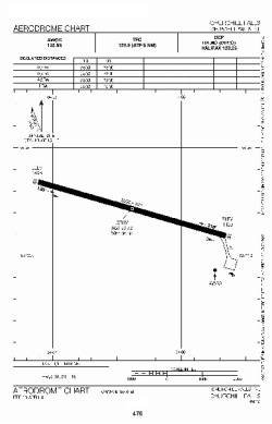
| Name: | Churchill Falls Airport |
| ICAO / IATA: | CZUM / ZUM |
Details |
| Type: | Airport (Airfield) |
| Use: | Public/Civil |
| Latitude: | 53°33'45"N (53.562500) |
| Longitude: | 64°06'21"W (-64.105832) |
| Elevation: | 1442 ft (440 m) |
| Runways: | 1 |
| Longest: | 5500 ft (1676 m) |
Time |
| Timezone: | UTC+30:38 (DST+33:38) |
| Local Time: | |
Weather |
| METAR: | CZUM | 041416Z AUTO 11003KT 080V190 2 1/4SM -SN OVC023 M17/M20 A2968 RMK SLP099
|
| TAF: | CZUM | 041341Z 0414/0502 VRB03KT 11/2SM -SN OVC020 TEMPO 0414/0416 6SM -SN SCT020 BKN160
FM041600 VRB03KT P6SM SCT020 BKN160 TEMPO 0416/0418 BKN020
FM041800 29007KT P6SM FEW020 RMK FCST BASED ON AUTO OBS. NXT FCST BY 042000Z
|
Related Locations |
| Nearby: | |
| Farthest: | YCSK: 11532 mi / 18559 km
Casey Station [Casey Station Skiway], Wilkes Land, AQ |
Find: |
|
Other Information |
Maps:
|
Sources:
|
|