| Location |
| City: | | Tokyo, Tokyo, Japan |
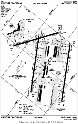
| Name: | Haneda |
| ICAO / IATA: | RJTT / HND |
Details |
| Type: | Airport (Aerodrome, Airfield) |
| Use: | Public/Civil |
| Latitude: | 35°33'12"N (35.553333) |
| Longitude: | 139°46'52"E (139.781111) |
| Elevation: | 21 ft (6 m) |
| Runways: | 4 |
| Longest: | 9843 × 197 ft (3000 × 60 m) |
Time |
| Timezone: | UTC+9 (DST+11) |
| Local Time: | |
Weather |
| METAR: | RJTT | 041404Z 35018G28KT 9999 FEW040 SCT060 08/M03 Q1016 RMK 1CU040 3SC060 A3003
|
| TAF: | RJTT | 041109Z 0412/0518 36014KT 9999 FEW030 BECMG 0503/0506 07010KT BECMG 0506/0509 13012KT BECMG 0515/0518 34008KT
|
Related Locations |
| Nearby: | |
| Farthest: | SUEX: 12288 mi / 19776 km
Montevideo East [Montevideo East UIR], UY |
Find: |
|
Other Information |
Maps:
|
Links:
|
Sources:
|
|