| Location |
| City: | | London, Surrey, England, United Kingdom |
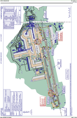
| Name: | Gatwick Airport |
| ICAO / IATA: | EGKK / LGW |
Details |
| Type: | Airport (Aerodrome, Airfield) |
| Use: | Public/Civil |
| Latitude: | 51°08'53"N (51.148056) |
| Longitude: | 0°11'25"W (-0.190277) |
| Elevation: | 203 ft (62 m) |
| Runways: | 2 |
| Longest: | 10879 × 148 ft (3316 × 45 m) |
Time |
| Timezone: | UTC+0 (DST+3) |
| Local Time: | |
Weather |
| METAR: | EGKK | 041350Z 21010G21KT 3600 DZ BKN006 08/07 Q1017
|
| TAF: | EGKK | 041105Z 0412/0518 21010KT 8000 -RADZ BKN008 PROB40 TEMPO 0412/0414 20015G25KT 4000 RADZ BKN004 PROB40 TEMPO 0414/0421 3000 RADZ BKN002 BECMG 0419/0421 VRB03KT SCT015 PROB40 TEMPO 0421/0512 BKN009 PROB30 TEMPO 0421/0509 0300 FG BKN001 BECMG 0509/0512 17010KT 9999 NSW PROB40 TEMPO 0512/0516 BKN012 PROB30 TEMPO 0516/0518 7000 -RA BKN005
|
Related Locations |
| Nearby: | |
| Farthest: | CHT: 11895 mi / 19143 km
Waitangi [Tuuta], CIT, NZ |
Find: |
|
Other Information |
Maps:
|
Links:
|
Sources:
|
|