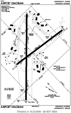
world map with LMO marked

LMO - Airport

This information may not be accurate or current and is not valid for navigation or flight planning. No warranty of fitness for any purpose is made or implied.

flag of Scotlandflag of United Kingdom

Donate via PayPal

Additional information is available on the NEW Great Circle Mapper

Location
City:  Lossiemouth, Morayshire, Scotland, United Kingdom
Name:RAF
ICAO / IATA:EGQS / LMO

Details
Type:Airport (Aerodrome, Airfield)
Use:Military
Latitude:57°42'19"N (57.705214)
Longitude:3°20'21"W (-3.339168)
Datum:WGS 1984
Elevation:42 ft (13 m)
Runways:2
Longest:9091 × 150 ft (2771 × 45.5 m)

Time
Timezone:UTC+0 (DST+1)
Local Time:

Weather
METAR:EGQS  120550Z 25007KT 9999 BKN034 03/02 Q1034 BLU
TAF:EGQS  120111Z 1203/1221 27007KT 9999 FEW025 BKN040= TAF EGVN 120119Z 1203/1303 VRB03KT 5000 HZ BKN015 TEMPO 1203/1218 4000 BR SCT010 PROB40 TEMPO 1203/1206 -RASN PROB30 TEMPO 1203/1206 -FZRA PROB40 TEMPO 1207/1212 SCT005 BECMG 1216/1219 3000 BR SCT006 PROB40 1218/1303 0300 FG BKN000

Related Locations
Nearby:
Farthest:SZS: 11602 mi / 18672 km
Ryan's Creek, Stewart Island, NZ

Find:

   beyond  
but within

Other Information
Maps:
Links:
Sources:


Airport Diagram

Airport diagram for LMO

Airport diagram (OBSOLETE) from NGA


Great Circle Mapper   Great Circle Mapper
Great Circle Mapper FAQ   Great Circle Mapper FAQ
  Karl's Home Page
KLSē   KLSē Home
   GC on Facebook
Airlines of the World   Airlines of the World
Donate via PayPal


Copyright © 2004-2012, Karl L. Swartz. All rights reserved.
All trademarks mentioned herein belong to their respective owners.

Please see credits for attribution and copyright information.

Karl Swartz <karl@kls2.com>
  Powered by FreeBSD
Valid HTML 4.01!
Labeled with ICRA
hCard Microformat
Geo Microformat