| Location |
| City: | | Manchester, England, United Kingdom |
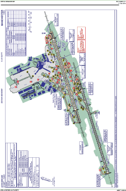
| Name: | Ringway International Airport |
| ICAO / IATA: | EGCC / MAN |
Details |
| Type: | Airport (Aerodrome, Airfield) |
| Use: | Public/Civil |
| Latitude: | 53°21'14"N (53.353889) |
| Longitude: | 2°16'30"W (-2.274999) |
| Elevation: | 257 ft (78 m) |
| Runways: | 2 |
| Longest: | 10007 × 148 ft (3050 × 45 m) |
Time |
| Timezone: | UTC+0 (DST+3) |
| Local Time: | |
Weather |
| METAR: | EGCC | 041350Z AUTO 29011KT 9999 SCT024 BKN033 08/02 Q1015
|
| TAF: | EGCC | 041103Z 0412/0518 27010KT 9999 SCT030 BECMG 0418/0421 21005KT PROB30 0419/0501 7000 PROB30 0501/0510 0300 FZFG VV/// BECMG 0509/0512 15010KT TEMPO 0516/0518 7000 RA BKN010
|
Related Locations |
| Nearby: | |
| Farthest: | NZBA: 11826 mi / 19033 km
Balclutha, OTA, NZ |
Find: |
|
Other Information |
Maps:
|
Sources:
|
|