world map with ACK marked

ACK - Airport

This information may not be accurate or current and is not valid for navigation or flight planning. No warranty of fitness for any purpose is made or implied.

flag of Massachusettsflag of United States

Donate via PayPal

Additional information is available on the NEW Great Circle Mapper

Location
City:  Nantucket, Massachusetts, United States
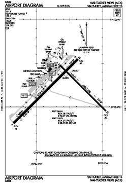
Name:Nantucket Memorial Airport
ICAO / IATA:KACK / ACK
FAA:ACK

Details
Type:Airport (Part 139 Class I)
Use:Public/Civil
Latitude:41°15'11"N (41.253111)
Longitude:70°03'37"W (-70.060305)
Datum:WGS 1984
Elevation:47 ft (14 m)
Runways:3
Longest:6303 × 150 ft (1921 × 45.5 m)

Time
Timezone:UTC-5 (DST-4)
Local Time:

Weather
METAR:KACK  112153Z 01014G20KT 9SM -RA BKN009 OVC014 02/01 A2943 RMK AO2 CIG 006V011 SLP967 P0000 T00220011 $
TAF:KACK  111742Z 1118/1212 36009KT 2SM RASN BR OVC003
FM112100 01015KT 1SM -SN BR OVC003
FM112200 01016KT 2SM -SN BR OVC008
FM120000 36018G28KT 2SM -SHSNRA BR OVC010
FM120200 35019KT 2SM BR OVC025
FM120400 35019KT P6SM OVC030

Related Locations
Nearby:
Farthest:MGV: 11854 mi / 19077 km
Margaret River, WA, AU

Find:

   beyond  
but within

Other Information
Maps:
Delays:
Links:
Sources:


Airport Diagram

Airport diagram for ACK

Airport diagram PDF from FAA

Sectional Chart

Flight Planning
at skyvector.com


Great Circle Mapper   Great Circle Mapper
Great Circle Mapper FAQ   Great Circle Mapper FAQ
  Karl's Home Page
KLSē   KLSē Home
   GC on Facebook
Airlines of the World   Airlines of the World
Donate via PayPal


Copyright © 2004-2012, Karl L. Swartz. All rights reserved.
All trademarks mentioned herein belong to their respective owners.

Please see credits for attribution and copyright information.

Karl Swartz <karl@kls2.com>
  Powered by FreeBSD
Valid HTML 4.01!
Labeled with ICRA
hCard Microformat
Geo Microformat