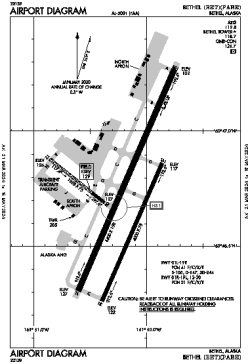
| Location |
| City: | | Bethel, Alaska, United States |
| ICAO / IATA: | PABE / BET |
| FAA: | BET |
Details |
| Type: | Airport (Part 139 Class I) |
| Use: | Public/Civil |
| Latitude: | 60°46'43"N (60.778556) |
| Longitude: | 161°50'14"W (-161.837166) |
| Datum: | WGS 1984 |
| Elevation: | 128 ft (39 m) |
| Runways: | 3 |
| Longest: | 6400 × 150 ft (1951 × 45.5 m) |
Time |
| Timezone: | UTC+25:08 (DST+28:08) |
| Local Time: | |
Weather |
| METAR: | PABE | 041413Z AUTO 06009KT 1/2SM R19R/2400V2800FT FZFG VV002 M02/M03 A2987 RMK AO2 I1001 T10221028 TSNO
|
| TAF: | PABE | 041139Z 0412/0512 04009KT 1/4SM FZFG VV002 TEMPO 0412/0416 1SM BR SCT002
FM041800 07015KT P6SM SCT007 OVC025
FM042000 09018KT 1SM -SN BLSN BKN007 OVC012
FM050200 13015G22KT 1SM -RASN BKN004
FM050800 16016G24KT 3SM BR SCT004 BKN025
|
Related Locations |
| Nearby: | |
| Farthest: | FAME: 11188 mi / 18006 km
Marion Island, Prince Edward Islands, WC, ZA |
Find: |
|
Other Information |
Maps:
|
Delays:
|
Links:
|
Sources:
|
|