| Location |
| City: | | Columbia, Missouri, United States |
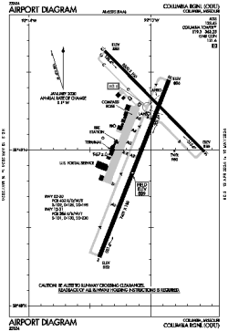
| Name: | Columbia Regional |
| ICAO / IATA: | KCOU / COU |
| FAA: | COU |
Details |
| Type: | Airport (Part 139 Class I) |
| Use: | Public/Civil |
| Latitude: | 38°49'04"N (38.817735) |
| Longitude: | 92°13'04"W (-92.217791) |
| Datum: | WGS 1984 |
| Elevation: | 889 ft (271 m) |
| Runways: | 2 |
| Longest: | 7401 × 150 ft (2256 × 45.5 m) |
Time |
| Timezone: | UTC+28:08 (DST+31:08) |
| Local Time: | |
Weather |
| METAR: | KCOU | 041354Z 17009KT 10SM BKN065 13/11 A2969 RMK AO2 SLP050 T01330106
|
| TAF: | KCOU | 041343Z 0414/0512 16008KT P6SM VCSH SCT030 OVC050
FM041600 19007KT P6SM VCSH OVC015
FM041700 32012G20KT P6SM OVC008
FM042000 32012KT P6SM OVC014
FM050000 33009KT P6SM BKN015
|
Related Locations |
| Nearby: | |
| Farthest: | YAUG: 10895 mi / 17534 km
Augusta [Augusta Airport], WA, AU |
Find: |
|
Other Information |
Maps:
|
Delays:
|
Links:
|
Sources:
|
|