| Location |
| City: | | Decatur, Illinois, United States |
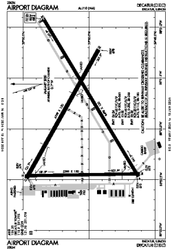
| ICAO / IATA: | KDEC / DEC |
| FAA: | DEC |
Details |
| Type: | Airport (Part 139 Class I) |
| Use: | Public/Civil |
| Latitude: | 39°50'04"N (39.834562) |
| Longitude: | 88°51'56"W (-88.865688) |
| Datum: | WGS 1984 |
| Elevation: | 681 ft (208 m) |
| Runways: | 3 |
| Longest: | 8496 × 150 ft (2590 × 45.5 m) |
Time |
| Timezone: | UTC+28:08 (DST+31:08) |
| Local Time: | |
Weather |
| METAR: | KDEC | 041354Z 18011KT 7SM OVC007 10/09 A2975 RMK AO2 SLP075 T01000089
|
| TAF: | KDEC | 041126Z 0412/0512 19013G20KT P6SM OVC035 WS015/21045KT
FM041400 19012G20KT P6SM VCSH OVC016
FM041600 20013G21KT 6SM -SHRA OVC008
FM042200 31011KT P6SM BKN011
FM050400 32010KT P6SM SCT014
|
Related Locations |
| Nearby: | |
| Farthest: | YAUG: 11066 mi / 17809 km
Augusta [Augusta Airport], WA, AU |
Find: |
|
Other Information |
Maps:
|
Delays:
|
Links:
|
Sources:
|
|