| Location |
| City: | | Edwards, California, United States |
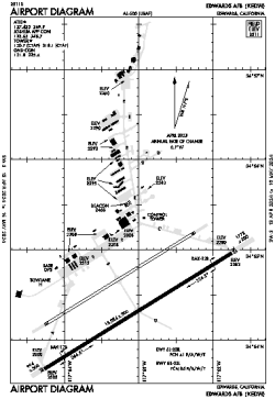
| Name: | Edwards AFB |
| ICAO / IATA: | KEDW / EDW |
| FAA: | EDW |
Details |
| Type: | Airport (Airfield) |
| Use: | Military |
| Latitude: | 34°54'29"N (34.908088) |
| Longitude: | 117°53'08"W (-117.885528) |
| Datum: | WGS 1984 |
| Elevation: | 2311 ft (704 m) |
| Runways: | 3 |
| Longest: | 15024 × 300 ft (4579 × 91.5 m) |
Time |
| Timezone: | UTC+26:08 (DST+29:08) |
| Local Time: | |
Weather |
| METAR: | KEDW | 041358Z 23017KT 20SM -RA BKN036 BKN046 08/08 A2973 RMK AO2A SLP066 P0000 T00760076
|
| TAF: | KEDW | 041002Z 0410/0516 23012KT 9999 SCT055 BKN065 QNH2974INS BECMG 0418/0419 22015G25KT 9000 -SHRA BKN025 OVC050 520005 QNH2973INS TEMPO 0419/0423 23020G35KT 530006 BECMG 0423/0424 22018KT 9000 -DZ SCT030 BKN060 QNH2971INS TEMPO 0500/0504 23025G35KT 530005 BECMG 0503/0504 22015G25KT 9999 NSW FEW035 SCT070 520004 QNH2970INS BECMG 0513/0514 22012KT 9999 SCT020 QNH2974INS BECMG 0515/0516 22018KT 9999 SCT015 QNH2977INS TX11/0422Z TN05/0415Z
|
Related Locations |
| Nearby: | |
| Farthest: | ZSE: 11412 mi / 18366 km
St-Pierre (St-Pierre de la Réunion) [Pierrefonds], RE |
Find: |
|
Other Information |
Maps:
|
Links:
|
Sources:
|
|