| Location |
| City: | | Elmira/Corning, New York, United States |
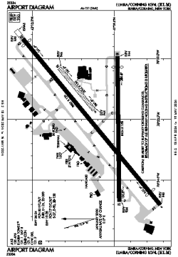
| Name: | Elmira/Corning Regional |
| ICAO / IATA: | KELM / ELM |
| FAA: | ELM |
Details |
| Type: | Airport (Part 139 Class I) |
| Use: | Public/Civil |
| Latitude: | 42°09'35"N (42.159855) |
| Longitude: | 76°53'30"W (-76.891747) |
| Datum: | WGS 1984 |
| Elevation: | 955 ft (291 m) |
| Runways: | 3 |
| Longest: | 8001 × 150 ft (2439 × 45.5 m) |
Time |
| Timezone: | UTC+29:08 (DST+32:08) |
| Local Time: | |
Weather |
| METAR: | KELM | 041353Z 00000KT 10SM CLR 03/01 A3004 RMK AO2 SLP180 T00280006
|
| TAF: | KELM | 041132Z 0412/0512 VRB04KT P6SM BKN060
FM041800 VRB04KT P6SM SCT080
FM050300 21007KT P6SM OVC050
FM050800 22006KT P6SM OVC030
|
Related Locations |
| Nearby: | |
| Farthest: | YAUG: 11590 mi / 18652 km
Augusta [Augusta Airport], WA, AU |
Find: |
|
Other Information |
Maps:
|
Delays:
|
Links:
|
Sources:
|
|