| Location |
| City: | | Galveston, Texas, United States |
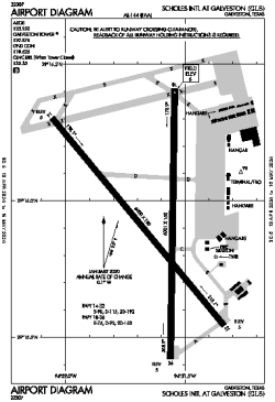
| Name: | Scholes International at Galveston |
| ICAO / IATA: | KGLS / GLS |
| FAA: | GLS |
Details |
| Type: | Airport (Airfield) |
| Use: | Public/Civil |
| Latitude: | 29°15'55"N (29.265333) |
| Longitude: | 94°51'37"W (-94.860416) |
| Datum: | WGS 1984 |
| Elevation: | 5 ft (2 m) |
| Runways: | 2 |
| Longest: | 6001 × 150 ft (1829 × 45.5 m) |
Time |
| Timezone: | UTC+28:08 (DST+31:08) |
| Local Time: | |
Weather |
| METAR: | KGLS | 041352Z 16005KT 1/8SM FG VV002 18/18 A2995 RMK AO2 SLP140 T01780178 $
|
| TAF: | KGLS | 041305Z 0413/0512 16006KT 1/4SM FG OVC002 TEMPO 0414/0416 1SM BR
FM041700 18007KT 3SM BR OVC006
FM042000 19009KT 6SM BR SCT008 BKN015
FM050100 16007KT 4SM BR BKN009 OVC012
FM050300 15007KT 1SM BR OVC004
FM050500 16007KT 1/2SM FG OVC002 AMD NOT SKED
|
Related Locations |
| Nearby: | |
| Farthest: | CCK: 11040 mi / 17767 km
West Island (Pulau Panjang) [Cocos (Keeling) Islands], CC |
Find: |
|
Other Information |
Maps:
|
Links:
|
Sources:
|
|