| Location |
| City: | | Idaho Falls, Idaho, United States |
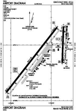
| Name: | Idaho Falls Regional |
| ICAO / IATA: | KIDA / IDA |
| FAA: | IDA |
Details |
| Type: | Airport (Part 139 Class I) |
| Use: | Public/Civil |
| Latitude: | 43°30'49"N (43.513673) |
| Longitude: | 112°04'15"W (-112.070819) |
| Datum: | WGS 1984 |
| Elevation: | 4743 ft (1446 m) |
| Runways: | 2 |
| Longest: | 9002 × 150 ft (2744 × 45.5 m) |
Time |
| Timezone: | UTC+27:08 (DST+30:08) |
| Local Time: | |
Weather |
| METAR: | KIDA | 041410Z 18011KT 1 1/2SM -SN BR BKN003 OVC026 00/M01 A2953 RMK AO2 P0000 T00001006
|
| TAF: | KIDA | 041120Z 0412/0512 21011KT 4SM -RASN BR SCT008 OVC015 TEMPO 0412/0415 1SM -SN BR SCT004 OVC009
FM041500 22010KT P6SM VCSH BKN009 BKN015
FM042300 18006KT P6SM VCSH SCT015 BKN040
FM050300 VRB05KT 6SM -SHRASN BKN015 OVC035
FM050700 17010KT P6SM VCSH BKN010 BKN050
|
Related Locations |
| Nearby: | |
| Farthest: | FAME: 10962 mi / 17642 km
Marion Island, Prince Edward Islands, WC, ZA |
Find: |
|
Other Information |
Maps:
|
Delays:
|
Links:
|
Sources:
|
|