| Location |
| City: | | Wenatchee, Washington, United States |
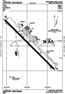
| Name: | Pangborn Memorial Airport |
| ICAO / IATA: | KEAT / EAT |
| FAA: | EAT |
Details |
| Type: | Airport (Part 139 Class I) |
| Use: | Public/Civil |
| Latitude: | 47°23'56"N (47.398806) |
| Longitude: | 120°12'25"W (-120.206832) |
| Datum: | WGS 1984 |
| Elevation: | 1248 ft (380 m) |
| Runways: | 1 |
| Longest: | 7000 × 150 ft (2134 × 45.5 m) |
Time |
| Timezone: | UTC+26:08 (DST+29:08) |
| Local Time: | |
Weather |
| METAR: | KEAT | 041355Z AUTO 30005KT 6SM -SN BR OVC037 M08/M10 A2958 RMK AO2 SLP031 P0000 T10781100
|
| TAF: | KEAT | 041356Z 0414/0512 30007KT 3SM -SN BR OVC025 TEMPO 0414/0418 1SM -SN BR BKN015 OVC025
FM041900 32007KT 3SM -SN BR BKN012 OVC025
FM042100 34012KT P6SM SCT008 OVC050
|
Related Locations |
| Nearby: | |
| Farthest: | FAME: 11408 mi / 18360 km
Marion Island, Prince Edward Islands, WC, ZA |
Find: |
|
Other Information |
Maps:
|
Links:
|
Sources:
|
|