| Location |
| City: | | Norfolk, Virginia, United States |
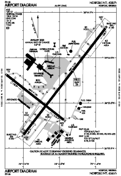
| Name: | Norfolk International Airport |
| ICAO / IATA: | KORF / ORF |
| FAA: | ORF |
Details |
| Type: | Airport (Part 139 Class I) |
| Use: | Public/Civil |
| Latitude: | 36°53'41"N (36.894604) |
| Longitude: | 76°12'04"W (-76.201228) |
| Datum: | WGS 1984 |
| Elevation: | 26 ft (8 m) |
| Runways: | 2 |
| Longest: | 9001 × 150 ft (2744 × 45.5 m) |
Time |
| Timezone: | UTC+29:08 (DST+32:08) |
| Local Time: | |
Weather |
| METAR: | KORF | 041351Z 03007KT 10SM OVC090 08/06 A3005 RMK AO2 SLP174 T00780061 $
|
| TAF: | KORF | 041139Z 0412/0512 03008KT P6SM OVC080
FM041600 03010KT P6SM OVC080
FM050000 02004KT P6SM BKN120
FM050800 25004KT P6SM SCT250
|
Related Locations |
| Nearby: | |
| Farthest: | YAUG: 11780 mi / 18958 km
Augusta [Augusta Airport], WA, AU |
Find: |
|
Other Information |
Maps:
|
Delays:
|
Links:
|
Sources:
|
|