| Location |
| City: | | Providence, Rhode Island, United States |
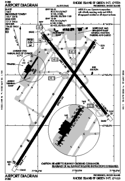
| Name: | Rhode Island Tf Green International Airport |
| ICAO / IATA: | KPVD / PVD |
| FAA: | PVD |
Details |
| Type: | Airport (Part 139 Class I) |
| Use: | Public/Civil |
| Latitude: | 41°43'20"N (41.722333) |
| Longitude: | 71°25'40"W (-71.427721) |
| Datum: | WGS 1984 |
| Elevation: | 54 ft (16 m) |
| Runways: | 2 |
| Longest: | 8700 × 150 ft (2652 × 45.5 m) |
Time |
| Timezone: | UTC+29:08 (DST+32:08) |
| Local Time: | |
Weather |
| METAR: | KPVD | 041351Z 19005KT 10SM BCFG BKN300 04/03 A3009 RMK AO2 SLP188 BCFG SW T00440028
|
| TAF: | KPVD | 041140Z 0412/0512 VRB03KT 3SM BR FEW250
FM041230 22005KT P6SM FEW250
FM042100 21006KT P6SM SKC
FM042200 20005KT P6SM FEW250
|
Related Locations |
| Nearby: | |
| Farthest: | YAUG: 11811 mi / 19008 km
Augusta [Augusta Airport], WA, AU |
Find: |
|
Other Information |
Maps:
|
Delays:
|
Links:
|
Sources:
|
|