| Location |
| City: | | Grand Forks, North Dakota, United States |
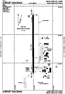
| Name: | Grand Forks AFB |
| ICAO: | KRDR |
| FAA: | RDR |
Details |
| Type: | Airport (Airfield) |
| Use: | Military |
| Latitude: | 47°57'41"N (47.961280) |
| Longitude: | 97°24'03"W (-97.400813) |
| Datum: | WGS 1984 |
| Elevation: | 910 ft (277 m) |
| Runways: | 1 |
| Longest: | 12351 × 150 ft (3765 × 45.5 m) |
Time |
| Timezone: | UTC+28:08 (DST+31:08) |
| Local Time: | |
Weather |
| METAR: | KRDR | 041356Z 36018G26KT 350V080 3SM -SN BLSN OVC006 M21/M25 A3002 RMK PK WND 34028/19 OVC V BKN SLP200 P0000 T12131246 $
|
| TAF: | KRDR | 041015Z 0410/0516 36015G20KT 6000 -SN BLSN OVC006 620062 QNH2995INS BECMG 0415/0416 34015G25KT 3200 -SN BLSN OVC008 620082 510108 QNH3002INS BECMG 0418/0419 35015G25KT 8000 BR OVC020 510003 QNH3008INS BECMG 0422/0423 34010G15KT 9999 NSW BKN020 QNH3015INS BECMG 0503/0504 34009KT 9999 BKN030 QNH3020INS TXM20/0410Z TNM25/0510Z
|
Related Locations |
| Nearby: | |
| Farthest: | YCSK: 10808 mi / 17394 km
Casey Station [Casey Station Skiway], Wilkes Land, AQ |
Find: |
|
Other Information |
Maps:
|
Links:
|
Sources:
|
|