| Location |
| City: | | Topeka, Kansas, United States |
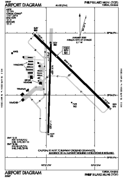
| Name: | Philip Billard Municipal Airport |
| ICAO / IATA: | KTOP / TOP |
| FAA: | TOP |
Details |
| Type: | Airport (Airfield) |
| Use: | Public/Civil |
| Latitude: | 39°04'08"N (39.068823) |
| Longitude: | 95°37'21"W (-95.622375) |
| Datum: | WGS 1984 |
| Elevation: | 881 ft (269 m) |
| Runways: | 2 |
| Longest: | 5099 × 100 ft (1554 × 30.5 m) |
Time |
| Timezone: | UTC+28:08 (DST+31:08) |
| Local Time: | |
Weather |
| METAR: | KTOP | 041353Z 32015G24KT 10SM OVC012 M03/M06 A2988 RMK AO2 SLP121 T10281056
|
| TAF: | KTOP | 041133Z 0412/0512 33017G28KT P6SM OVC007
FM041500 35014G26KT P6SM BKN015
FM041600 35014G22KT P6SM FEW015
FM042100 35011KT P6SM FEW250
FM050900 06008KT P6SM FEW020 BKN200
|
Related Locations |
| Nearby: | |
| Farthest: | YAUG: 10711 mi / 17238 km
Augusta [Augusta Airport], WA, AU |
Find: |
|
Other Information |
Maps:
|
Links:
|
Sources:
|
|