world map with ORH marked

ORH - Airport

This information may not be accurate or current and is not valid for navigation or flight planning. No warranty of fitness for any purpose is made or implied.

flag of Massachusettsflag of United States

Donate via PayPal

Additional information is available on the NEW Great Circle Mapper

Location
City:  Worcester, Massachusetts, United States
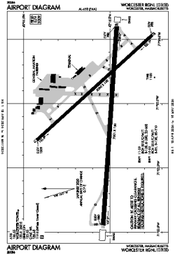
Name:Worcester Regional
ICAO / IATA:KORH / ORH
FAA:ORH

Details
Type:Airport (Part 139 Class I)
Use:Public/Civil
Latitude:42°16'02"N (42.267139)
Longitude:71°52'32"W (-71.875610)
Datum:WGS 1984
Elevation:1009 ft (308 m)
Runways:2
Longest:7001 × 150 ft (2134 × 45.5 m)

Time
Timezone:UTC-5 (DST-4)
Local Time:

Weather
METAR:KORH  111454Z 03007KT 10SM SCT012 BKN055 M01/M04 A2971 RMK AO2 SNE26 SLP070 P0000 60001 T10061039 58014 $
TAF:KORH  111141Z 1112/1212 VRB03KT 2SM -SN BR OVC030
FM111400 35005KT P6SM -SN OVC025
FM111700 01007KT P6SM -SN OVC015
FM111900 01007KT P6SM OVC015
FM112100 36008KT P6SM OVC025
FM120100 34010KT P6SM BKN040
FM120300 33012KT P6SM BKN050
FM120800 31014G20KT P6SM SCT250 AMD NOT SKED

Related Locations
Nearby:
Farthest:MGV: 11745 mi / 18902 km
Margaret River, WA, AU

Find:

   beyond  
but within

Other Information
Maps:
Delays:
Links:
Sources:


Airport Diagram

Airport diagram for ORH

Airport diagram PDF from FAA

Sectional Chart

Flight Planning
at skyvector.com


Great Circle Mapper   Great Circle Mapper
Great Circle Mapper FAQ   Great Circle Mapper FAQ
  Karl's Home Page
KLSē   KLSē Home
   GC on Facebook
Airlines of the World   Airlines of the World
Donate via PayPal


Copyright © 2004-2012, Karl L. Swartz. All rights reserved.
All trademarks mentioned herein belong to their respective owners.

Please see credits for attribution and copyright information.

Karl Swartz <karl@kls2.com>
  Powered by FreeBSD
Valid HTML 4.01!
Labeled with ICRA
hCard Microformat
Geo Microformat