| Location |
| City: | | Owensboro, Kentucky, United States |
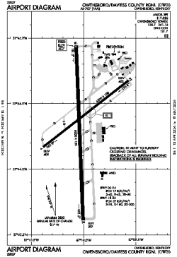
| Name: | Owensboro/Daviess County Regional |
| ICAO / IATA: | KOWB / OWB |
| FAA: | OWB |
Details |
| Type: | Airport (Part 139 Class I) |
| Use: | Public/Civil |
| Latitude: | 37°44'20"N (37.738834) |
| Longitude: | 87°10'01"W (-87.166828) |
| Datum: | WGS 1984 |
| Elevation: | 407 ft (124 m) |
| Runways: | 2 |
| Longest: | 8000 × 150 ft (2438 × 45.5 m) |
Time |
| Timezone: | UTC+28:08 (DST+31:08) |
| Local Time: | |
Weather |
| METAR: | KOWB | 041356Z COR 18008KT 8SM -RA BKN042 OVC075 11/10 A2990 RMK AO2 RAB24 SLP139 P0002 T01110100
|
| TAF: | KOWB | 041120Z 0412/0512 17010KT P6SM BKN090 WS020/21035KT
FM041500 18013KT P6SM VCSH OVC025
FM050300 22008KT P6SM OVC008
FM050600 30008KT P6SM OVC003
FM050800 33009KT P6SM OVC008
|
Related Locations |
| Nearby: | |
| Farthest: | YAUG: 11174 mi / 17983 km
Augusta [Augusta Airport], WA, AU |
Find: |
|
Other Information |
Maps:
|
Links:
|
Sources:
|
|