| Location |
| City: | | Philadelphia, Pennsylvania, United States |
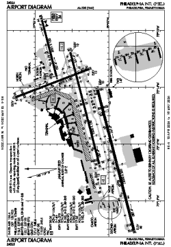
| Name: | Philadelphia International Airport |
| ICAO / IATA: | KPHL / PHL |
| FAA: | PHL |
Details |
| Type: | Airport (Part 139 Class I) |
| Use: | Public/Civil |
| Latitude: | 39°52'20"N (39.872084) |
| Longitude: | 75°14'26"W (-75.240662) |
| Datum: | WGS 1984 |
| Elevation: | 35 ft (11 m) |
| Runways: | 4 |
| Longest: | 12000 × 200 ft (3658 × 61 m) |
Time |
| Timezone: | UTC+29:08 (DST+32:08) |
| Local Time: | |
Weather |
| METAR: | KPHL | 041402Z 00000KT 5SM BR FEW280 03/01 A3011 RMK AO2 T00330011
|
| TAF: | KPHL | 041120Z 0412/0518 VRB03KT 4SM BR SCT250
FM041500 VRB03KT P6SM SCT250
FM041800 20005KT P6SM SCT250
FM050300 20003KT 6SM BR BKN200
FM050900 20003KT 5SM BR OVC100
FM051400 25005KT 6SM BR OVC050
|
Related Locations |
| Nearby: | |
| Farthest: | YAUG: 11750 mi / 18910 km
Augusta [Augusta Airport], WA, AU |
Find: |
|
Other Information |
Maps:
|
Delays:
|
Links:
|
Sources:
|
|