| Location |
| City: | | Universal City, Texas, United States |
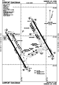
| Name: | Randolph AFB |
| ICAO / IATA: | KRND / RND |
| FAA: | RND |
Details |
| Type: | Airport (Airfield) |
| Use: | Military |
| Latitude: | 29°31'44"N (29.528906) |
| Longitude: | 98°16'41"W (-98.278030) |
| Datum: | WGS 1984 |
| Elevation: | 760 ft (232 m) |
| Runways: | 2 |
| Longest: | 8352 × 200 ft (2546 × 61 m) |
Time |
| Timezone: | UTC+28:08 (DST+31:08) |
| Local Time: | |
Weather |
| METAR: | KRND | 041413Z 18003KT 1SM BR OVC003 19/19 A2991 RMK VIS 1 1/2 RWY15R VIS 1 1/8 RWY33L VIS 1 5/8 RWY33R CIG 002 RWY15R SLP124
|
| TAF: | KRND | 041242Z 0412/0516 19005KT 4800 BR OVC006 QNH2984INS TEMPO 0413/0415 1600 BR BECMG 0414/0415 20005KT 2400 BR OVC007 QNH2991INS BECMG 0418/0419 21005KT 6000 -DZ BKN015 OVC030 QNH2992INS BECMG 0421/0422 18004KT 9999 NSW SCT015 OVC030 QNH2985INS BECMG 0502/0503 18004KT 4800 BR OVC006 QNH2989INS TEMPO 0509/0514 0800 FG VV002 TX24/0420Z TN17/0412Z
|
Related Locations |
| Nearby: | |
| Farthest: | RRG: 11109 mi / 17878 km
Plaine Corail [Sir Gaëtan Duval Airport (Plaine Corail Airport)], Rodrigues Island, MU |
Find: |
|
Other Information |
Maps:
|
Links:
|
Sources:
|
|