| Location |
| City: | | Salem, Oregon, United States |
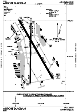
| Name: | McNary Field |
| ICAO / IATA: | KSLE / SLE |
| FAA: | SLE |
Details |
| Type: | Airport (Part 139 Class I) |
| Use: | Public/Civil |
| Latitude: | 44°54'34"N (44.909528) |
| Longitude: | 123°00'09"W (-123.002499) |
| Datum: | WGS 1984 |
| Elevation: | 213 ft (65 m) |
| Runways: | 2 |
| Longest: | 5811 × 150 ft (1771 × 45.5 m) |
Time |
| Timezone: | UTC+26:08 (DST+29:08) |
| Local Time: | |
Weather |
| METAR: | KSLE | 041356Z AUTO 15005KT 10SM UP OVC041 02/00 A2943 RMK AO2 UPB01 SLP966 P0000 I1000 T00170000
|
| TAF: | KSLE | 041242Z 0413/0512 15005KT P6SM -SHRASN FEW007 BKN015 OVC030 TEMPO 0414/0418 1SM -SHSN BKN007 OVC020
FM041800 VRB03KT P6SM -SHSN SCT015 BKN025 OVC035 TEMPO 0418/0422 3SM -SHSN BKN015 OVC025
FM050300 02007KT P6SM VCSH BKN025 OVC045
|
Related Locations |
| Nearby: | |
| Farthest: | FAME: 11509 mi / 18522 km
Marion Island, Prince Edward Islands, WC, ZA |
Find: |
|
Other Information |
Maps:
|
Delays:
|
Links:
|
Sources:
|
|