| Location |
| City: | | Syracuse, New York, United States |
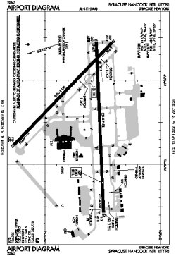
| Name: | Syracuse Hancock International Airport |
| ICAO / IATA: | KSYR / SYR |
| FAA: | SYR |
Details |
| Type: | Airport (Part 139 Class I) |
| Use: | Public/Civil |
| Latitude: | 43°06'40"N (43.111181) |
| Longitude: | 76°06'23"W (-76.106319) |
| Datum: | WGS 1984 |
| Elevation: | 421 ft (128 m) |
| Runways: | 2 |
| Longest: | 9014 × 150 ft (2747 × 45.5 m) |
Time |
| Timezone: | UTC+29:08 (DST+32:08) |
| Local Time: | |
Weather |
| METAR: | KSYR | 041354Z 09005KT 10SM FEW045 BKN070 BKN250 06/03 A2999 RMK AO2 SLP154 T00610028
|
| TAF: | KSYR | 041132Z 0412/0512 VRB04KT P6SM OVC035
FM041900 VRB04KT P6SM BKN250
FM050500 19008KT 6SM -SHRA OVC045
FM050900 25006KT P6SM OVC030
|
Related Locations |
| Nearby: | |
| Farthest: | YAUG: 11579 mi / 18634 km
Augusta [Augusta Airport], WA, AU |
Find: |
|
Other Information |
Maps:
|
Delays:
|
Links:
|
Sources:
|
|