| Location |
| City: | | Chapleau, Ontario, Canada |
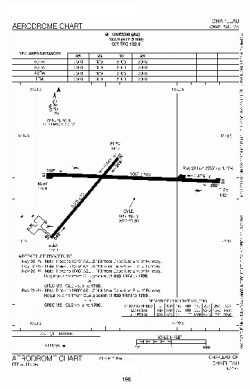
| Name: | Chapleau Airport |
| ICAO / IATA: | CYLD / YLD |
Details |
| Type: | Airport (Airfield) |
| Use: | Public/Civil |
| Latitude: | 47°49'13"N (47.820278) |
| Longitude: | 83°20'49"W (-83.346943) |
| Elevation: | 1470 ft (448 m) |
| Runways: | 2 |
| Longest: | 5003 ft (1525 m) |
Time |
| Timezone: | UTC+29:08 (DST+32:08) |
| Local Time: | |
Weather |
| METAR: | CYLD | 041400Z 05011G17KT 15SM -SN OVC008 M15/M17 A2986 RMK SC8 SLP153
|
| TAF: | CYLD | 041243Z 0413/0501 05010KT 11/2SM -SN BR OVC006 TEMPO 0413/0415 6SM -SN OVC012 PROB30 0413/0415 3SM -FZDZ BR OVC005
FM041500 08012G22KT 3/4SM -SN VV005 TEMPO 0415/0421 2SM -SNPL OVC010
FM050000 04012G22KT 2SM -SN VV008 RMK NXT FCST BY 042000Z
|
Related Locations |
| Nearby: | |
| Farthest: | YAUG: 11101 mi / 17865 km
Augusta [Augusta Airport], WA, AU |
Find: |
|
Other Information |
Maps:
|
Sources:
|
|